Outputting digital maps for print
2018Brief
In a digital world printed maps still have their place. Customers wanted to deploy printed maps as a cheaper alternative to installing digital directory hardware, or for pamphlet maps that were to be handed out for shoppers on the go.
Solution
Using the same digital map used for other products, customers could export a version that made it easy to produce printed maps. Prior to exporting, the tool provided you with the capability to colour sections, add labels, configure new categories, and control settings like map rotation. Once exported, your package contained an SVG of the map and an XML file formatted for direct import into InDesign.
UI & UX Design, Customer Interviews, User Testing, Prototyping
Sketch, InDesign, XML
Systems and methods for generating printable maps (US10606532B1)
Project Images
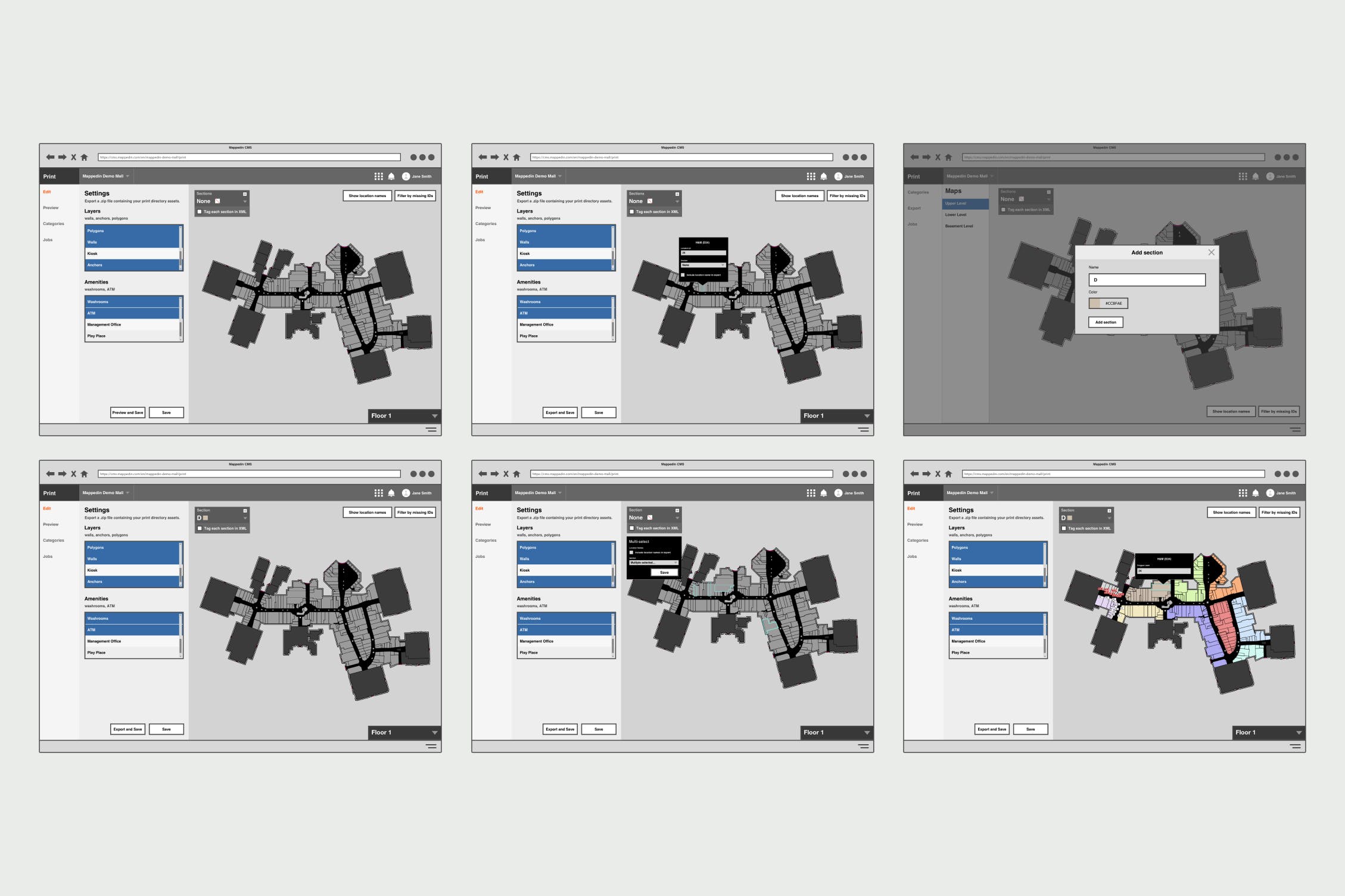
A lo-fi prototype was created to test complex interactions and get validation from our initial group of pilot customers. The labelling system allowed an easy way to point and click around the map to change colour and name attributes.
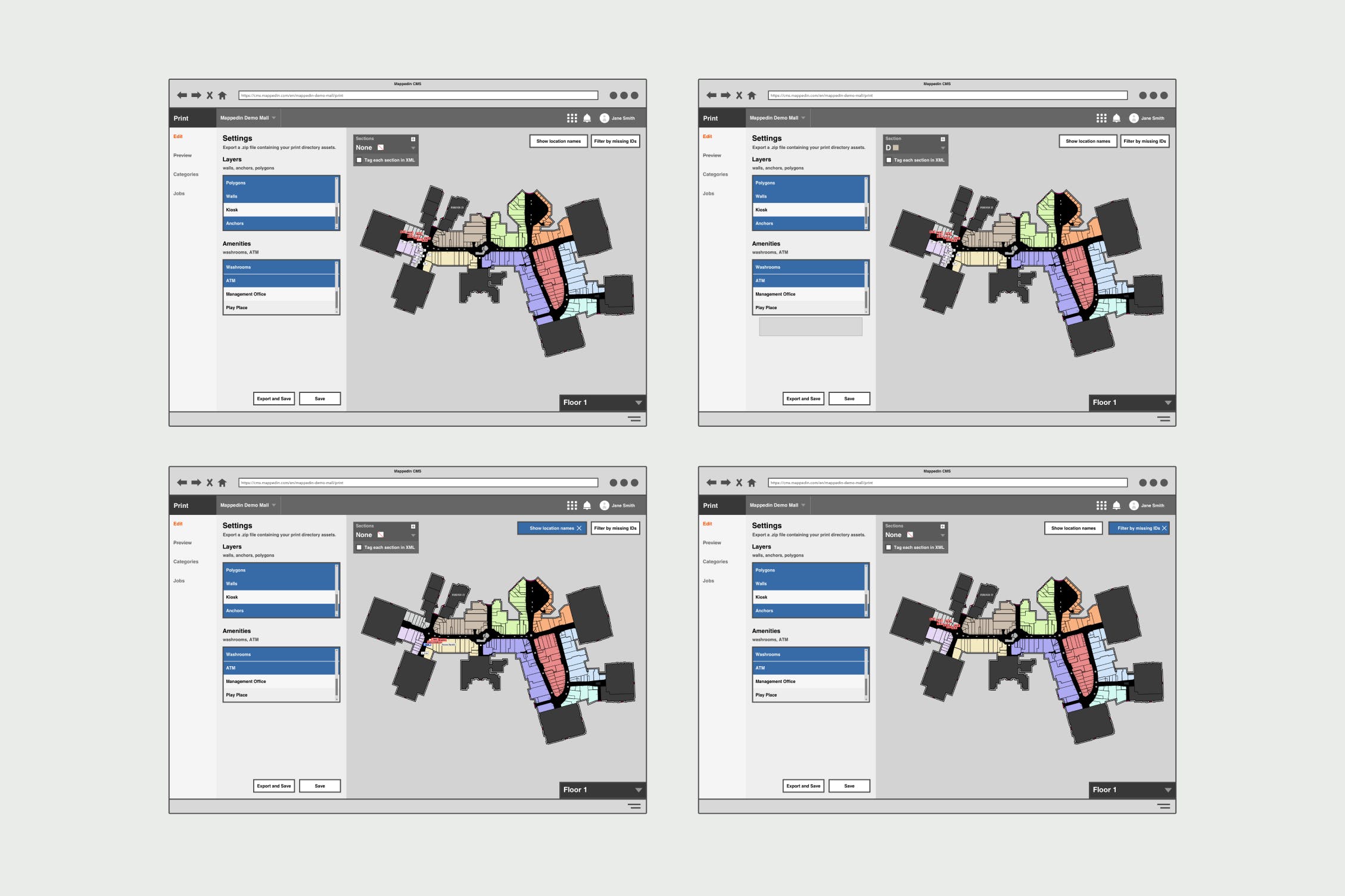
Filters allowed users to control what data is displayed on the map, reducing the amount of noise when checking things like labels with no IDs or seeing a label's full name.
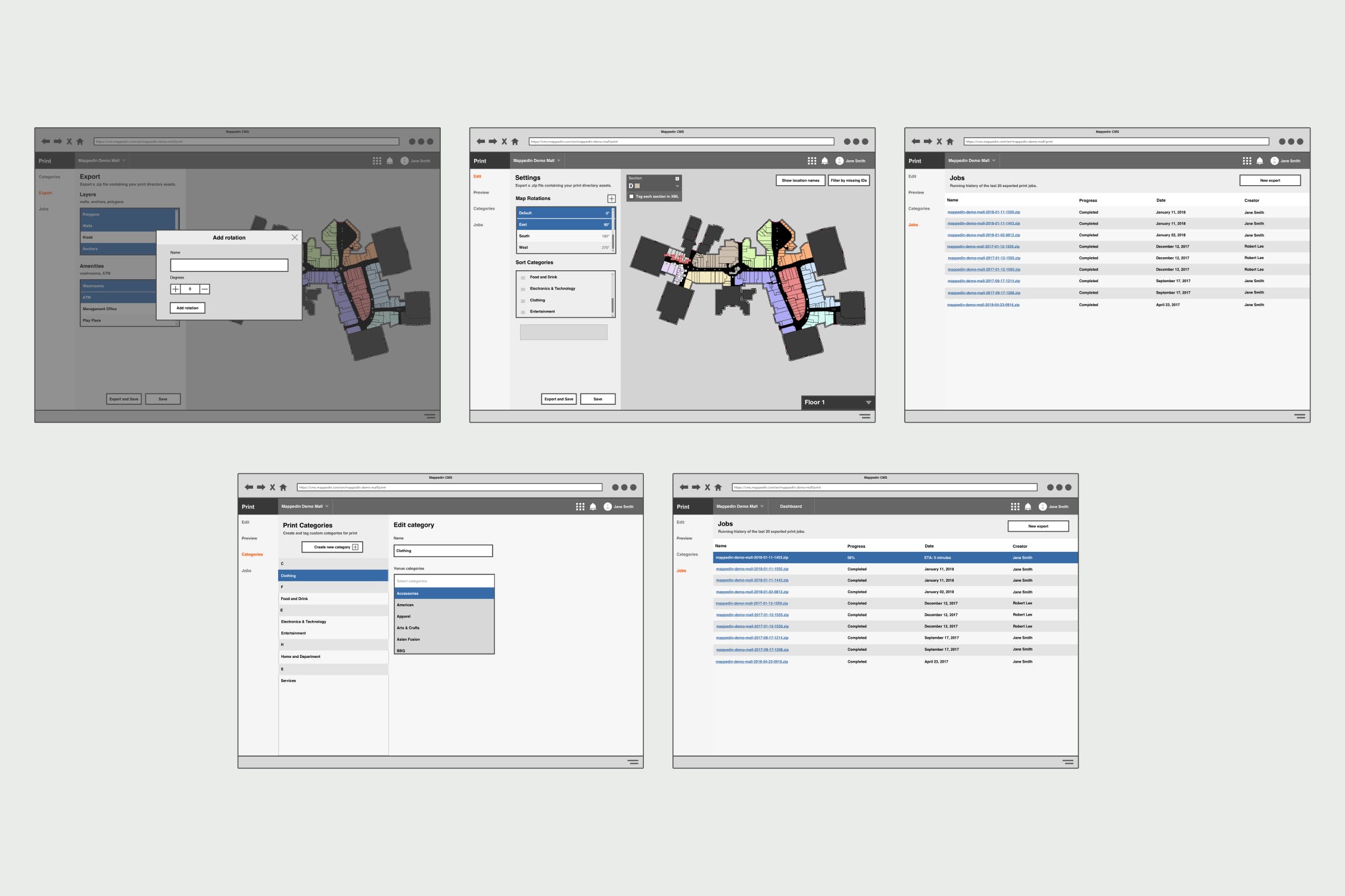
The goal of the export system was to provide an easy way to configure your export and download your package.
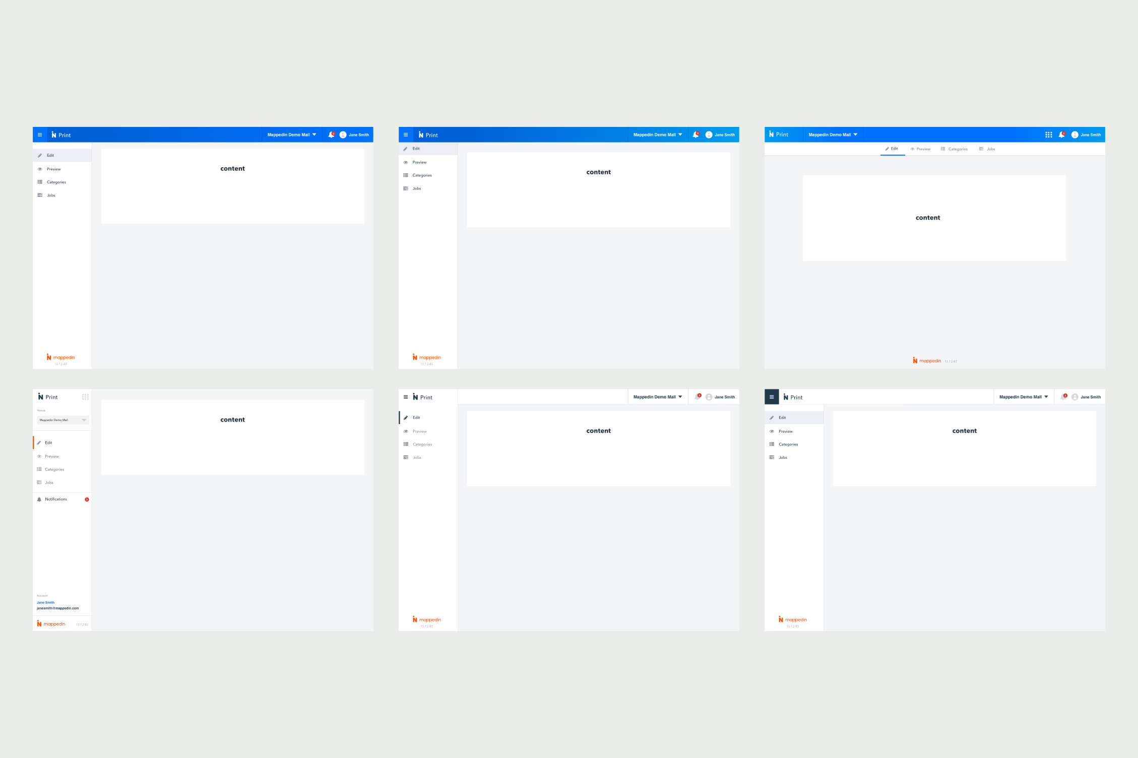
Testing out different navigation layouts.
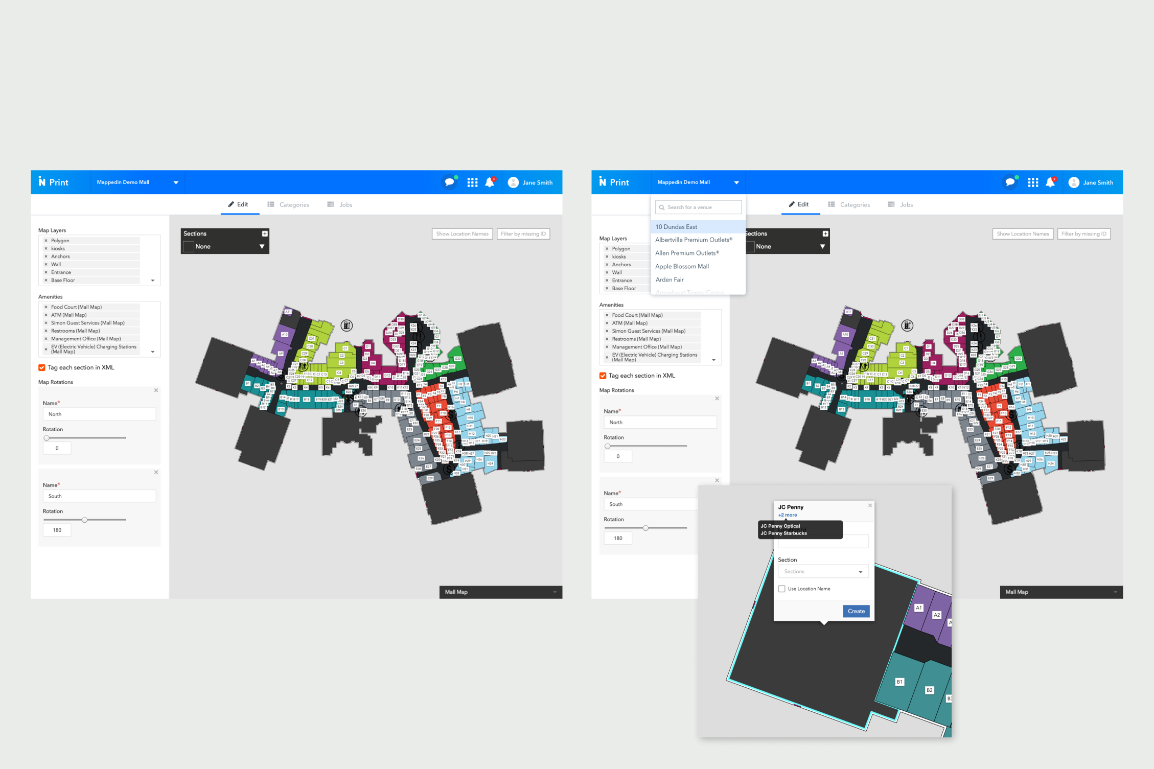
High-fidelity mockup of the edit tab of the product, using the final navigation design.
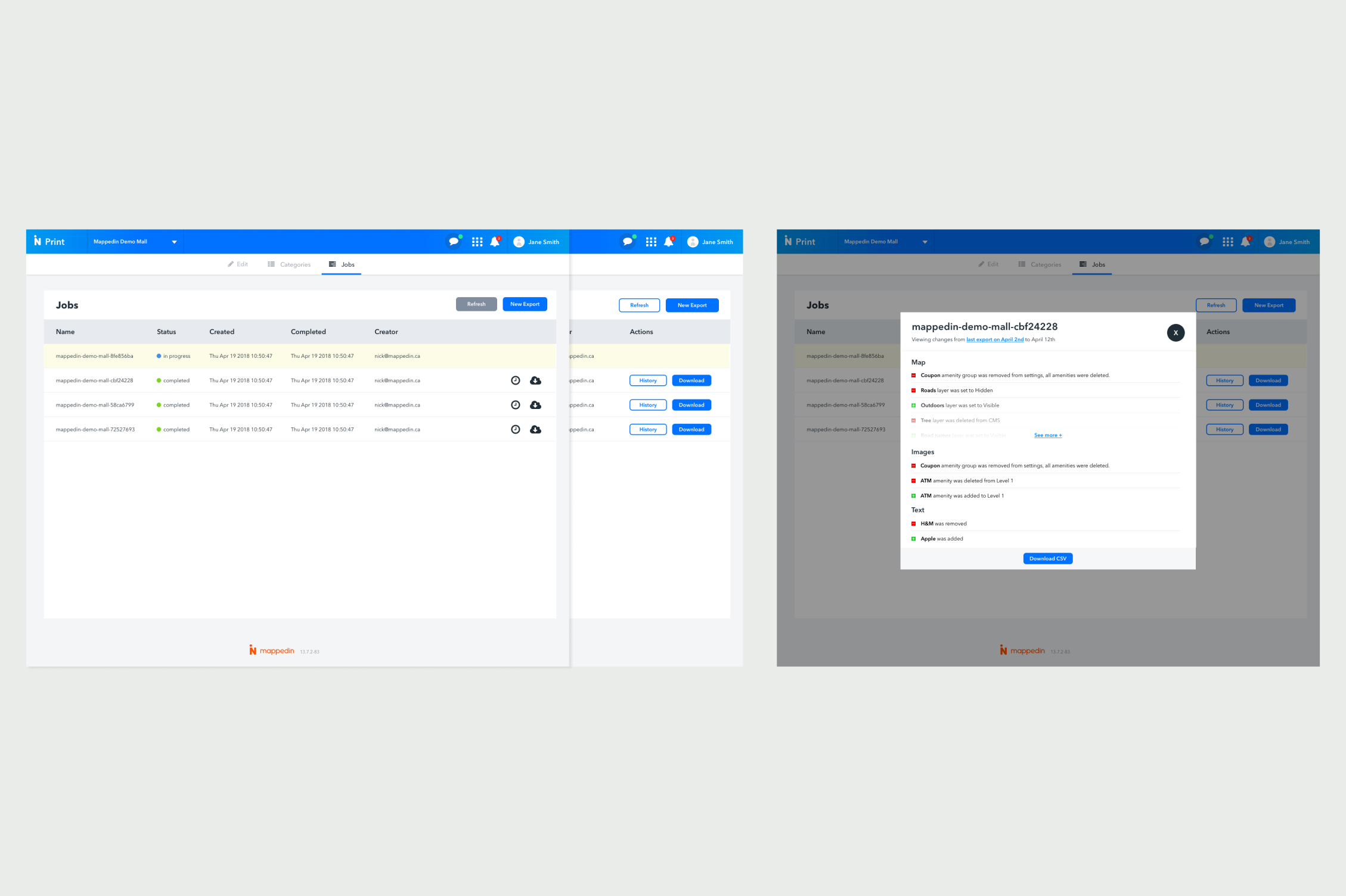
The export tab provides a list layout containing previously exported files.